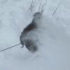
RidgeRacer Posted January 13, 2008 Report Posted January 13, 2008 They're calling for around 6 inches...Could be a great day. I'm going to try to get there early as long as the roads are in decent shape. Anyone else going? Quote
method9455 Posted January 13, 2008 Report Posted January 13, 2008 Have work .... would rather be there. Quote
phillycore Posted January 13, 2008 Report Posted January 13, 2008 say whut... 6" at Frost tomorrow... I must've missed the weather report somewhere... Quote
RidgeRacer Posted January 13, 2008 Author Report Posted January 13, 2008 (edited) Weather.com... SNOW ADVISORY IN EFFECT FROM 9 PM THIS EVENING TO 3 PM EST MONDAY... THE NATIONAL WEATHER SERVICE IN MOUNT HOLLY HAS ISSUED A SNOW ADVISORY, WHICH IS IN EFFECT FROM 9 PM THIS EVENING TO 3 PM EST MONDAY. SNOW IS EXPECTED TO OVERSPREAD THE AREA THIS EVENING AND CONTINUE OVERNIGHT AND MONDAY MORNING AND BE LOCALLY MODERATE TO HEAVY AT TIMES. HOWEVER, THE SNOW WILL MIX WITH OR EVEN BEGIN AS LIGHT RAIN IN THE LEHIGH VALLEY. THE AIR MASS IS EXPECTED TO COOL SUFFICIENTLY EVERYWHERE, THEREFORE SNOW IS ANTICIPATED TO BE THE MAIN PRECIPITATION TYPE WITH THIS STORM. THE SNOW WILL THEN BECOME INTERMITTENT DURING MONDAY MORNING. A STORM TOTAL OF 2 TO 6 INCHES OF SNOW IS ANTICIPATED, WITH THE HIGHER AMOUNTS PROBABLY OCCURRING ACROSS EASTERN NORTHAMPTON AND MONROE COUNTIES. THERE IS THE POTENTIAL FOR A FAIRLY SHARP GRADIENT IN THE SNOWFALL AMOUNTS TO OCCUR FROM WEST TO EAST. Even though it's says higher totals to the east, JF normally ends up on the higher end of that because of their elevation. Edited January 13, 2008 by PA Ridge Racer Quote
phillycore Posted January 13, 2008 Report Posted January 13, 2008 dayam... I stop looking at the weather for a day or 2 and look wtf I almost miss.... I need to lay off the crack pipe Quote
Kyle Posted January 13, 2008 Report Posted January 13, 2008 I need to lay off the crack pipe so do the groomers at blue. Quote
bigdaddyk Posted January 13, 2008 Report Posted January 13, 2008 I have to go to training, or I would be there . However, i'm off Thursday and Friday and they are calling for snow on those days....my luck that will change. Quote
RightEmpire Posted January 13, 2008 Report Posted January 13, 2008 Why does the JF snow report say 6" already? Quote
bigdaddyk Posted January 13, 2008 Report Posted January 13, 2008 Why does the JF snow report say 6" already? It looks like they anticipated it, since they posted for Monday already. Quote
Recommended Posts
Join the conversation
You can post now and register later. If you have an account, sign in now to post with your account.