JFskiDan Posted March 29, 2011 Report Posted March 29, 2011 SHORT TERM /6 AM WEDNESDAY MORNING THROUGH THURSDAY/... INCREASING CONSENSUS FOR A MAJOR NOREASTER THURSDAY NIGHT INTO APRIL FOOLS DAY. THURSDAY SHOULD START AS A RELATIVE LULL BETWEEN THE SYSTEMS. FORECAST SOUNDINGS ARE PRETTY SOCKED WITH LOW LEVEL MOISTURE AND THE NORTH TO NORTHEAST FLOW IS NOT CONDUCIVE TO CLEARING. SO WE MAY HAVE MORE LIGHT RAIN OR DRIZZLE EARLY, A BREAK MID DAY AND THEN THE ONSET OF PRECIPITATION BY THE END OF THE DAY. WE BACKED OFF ON THE GFS TIMING SOMEWHAT AS IT REMAINS THE FASTEST MODEL. THE LACK OF A SURFACE HIGH PRESSURE TO THE NORTH WILL KEEP THE BOUNDARY LAYER RELATIVELY MOIST AND WET BULB TEMPERATURES ABOVE FREEZING. WAS CONSERVATIVE WITH MAX TEMPS, MANY PLACES BELOW STAT GUIDANCE AGAIN BECAUSE OF CLOUDS AND ONSHORE FLOW. COME THURSDAY NIGHT AND EARLY FRIDAY ALL BETS ARE THEN OFF AS THE LOW IS FORECAST TO INTENSIFY FAIRLY RAPIDLY. THE GFS THERMAL FIELD IS COLDER THAN THE UKMET OR CAN GGEM (HI RES ECMWF NOT VIEWABLE IN TIME). BUT TO A CERTAIN EXTENT, IT DEPENDS UPON WHERE THE DEFORMATION BAND ESTABLISHES ITSELF AS DYNAMIC COOLING WOULD CHANGE THE RAIN TO SNOW REGARDLESS OF LOCATION. PAY ONE NOW OR PAY ONE LATER, WE SUPPOSE IF THE LOW WOULD TREND FARTHER TO THE WEST, THIS WOULD INCREASE THE HYDRO CONCERNS PARTICULARLY IN NJ AS EVENT TOTAL QPF BY THE GFS/CAN GGEM AND UKMET ARE AVERAGING 1.5 TO 2.5 INCHES. THE SYSTEM SHOULD BE EXITING OUR AREA AS FRIDAY CONTINUES AND ONCE THE INTENSITY IS LOST, PRECIPITATION COULD GO BACK TO RAIN. BECAUSE OF MARGINAL TEMPERATURES THIS HAS THE POTENTIAL TO BE A HEAVY WET SNOW EVENT, NOT EXACTLY A UTILITY`S DREAM. WE LOADED IN SOME CONSERVATIVE SNOW AMOUNTS IN THE GRIDS FOR NOW, BUT THIS SHOULD BE VIEWED AS A VERY FIRST GUESS WITH REVISIONS TO FOLLOW. BROUGHT MIN TEMPS CLOSER TO FREEZING FASTER OVERNIGHT BECAUSE OF ANTICIPATED MIXING OR CHANGEOVER AND WITH SNOW PROBABLE ON THE GROUND IN PARTS OF OUR CWA, WENT BELOW MEX MOS FOR MAX TEMPS. This is a pretty broad forcast from Delaware to upstate PA. Alot of the cosmic tumblers in the universe will really need to come together for this to really be great, but it could definetly be something. The 1.5 to 2.5 numbers they are using are liquid, not inches of snow. Quote
Johnny Law Posted March 29, 2011 Report Posted March 29, 2011 GFS was showing 1-2ft for virgina to vt Certainly don't think we'll see that but still pretty cool potential for April. Quote
Shadows Posted March 29, 2011 Report Posted March 29, 2011 ..APRIL FOOLS DAY. ALL BETS ARE THEN OFF AS PAY ONE NOW OR PAY ONE LATER, NOT EXACTLY A UTILITY`S DREAM.. love weather geeks write ups Quote
phillycore Posted March 30, 2011 Report Posted March 30, 2011 Bring it on mother nature you lil slut you. Drop the big load of pow on Pa.. Quote
Shadows Posted March 30, 2011 Report Posted March 30, 2011 Bring it on mother nature you lil slut you. Drop the big load of pow on Pa.. what kind of girls do you hangout with? Quote
moe ghoul Posted March 30, 2011 Report Posted March 30, 2011 Headin north Friday, destination unknown. Ullr is such a fluffer, I've been sportin a stoke boner since 5AM. Quote
Ride Delaware ? Posted March 30, 2011 Report Posted March 30, 2011 It is looking like a mixed bag for PA... Rain/Snow transitioning all to snow... Friday night at Boulder or CB may be the money shots... Great call on going north Moe... There is a ton of moisture with this system, so I wouldn't assume that it will be dry snow anywhere, but the farther north you go the lighter it should get (within reason). Looks like anywhere from the Skillz all the way to JP and SB will be winners... Have fun out there... Quote
Johnny Law Posted March 30, 2011 Report Posted March 30, 2011 Booyakasha......10 to 20" for my weekend excursion could be epic Quote
Ride Delaware ? Posted March 30, 2011 Report Posted March 30, 2011 Booyakasha......10 to 20" for my weekend excursion could be epic Going up to your hidden shack in the woods? Quote
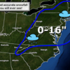
Sno Mountain Skier Posted March 30, 2011 Report Posted March 30, 2011 Does noaa have map out yet with what they expect to fall? I'm driving to the Bronx Friday morning, this drive may suck. Quote
Johnny Law Posted March 30, 2011 Report Posted March 30, 2011 Going up to your hidden shack in the woods? Nah no cabin there until spring, actually had a Dacks trip planned for this weekend since last year. Apparently my Karma is good. Quote
Johnny Law Posted March 30, 2011 Report Posted March 30, 2011 Does noaa have map out yet with what they expect to fall? I'm driving to the Bronx Friday morning, this drive may suck. GFS shows rain for the coast maybe up to 90miles inland. Accuweather says maybe 1-2" for NYC area. Quote
moe ghoul Posted March 30, 2011 Report Posted March 30, 2011 Nah no cabin there until spring, actually had a Dacks trip planned for this weekend since last year. Apparently my Karma is good. Dood, have a great time, is this the Peggy O hut trip? Quote
Johnny Law Posted March 30, 2011 Report Posted March 30, 2011 Dood, have a great time, is this the Peggy O hut trip? indeed, I'm hoping the east wind drives all that snow smack into the face were skiing. Quote
Sno Mountain Skier Posted March 30, 2011 Report Posted March 30, 2011 I hope it is like the last storm and melts off the roads rather quickly. Quote
JFskiDan Posted March 30, 2011 Author Report Posted March 30, 2011 I hope it is like the last storm and melts off the roads rather quickly. I'm with you on that one....a selective snow. one that only falls directly on the slopes. Quote
Recommended Posts
Join the conversation
You can post now and register later. If you have an account, sign in now to post with your account.