toast21602 Posted February 7, 2013 Report Posted February 7, 2013 gotta work and the roads are going to be miserable. i'll be up early on saturday if all goes as planned. i feel like shit now so i need to get some rest.
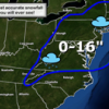
JFskiDan Posted February 8, 2013 Author Report Posted February 8, 2013 I like when NOAA is onboard with significant totals, since they seem to be a little on the conservative side at times. http://www.erh.noaa.gov/er/phi/briefing/packages/current_briefing.pdf
Ride Delaware ? Posted February 8, 2013 Report Posted February 8, 2013 Right now NOAA is giving Sunday River the most optimistic snowfall total of 16-24"... Our Winter Storm Warning is only calling for 6-12"... Snowfall started about 6 AM from the clipper, as it still hasn't merged with the coastal storm... Snow is super fluffy pow pizzly with incredibly low water density... Already gotten about 3-4"... It's only about 10 degrees, so that's helping keep it dry... It's a good thing we still have a little base in the woods because this is far from base building... Tomorrow should be good to get in the woods!!! 1
Schif Posted February 8, 2013 Report Posted February 8, 2013 I wonder which PA mountain is going to see the most out of all of this?
guitar73 Posted February 8, 2013 Report Posted February 8, 2013 i dunno, i bet elk and montage/sno will get hit pretty good as well....looked like that heavy band wraps around to the west of the catskills....could make it down that far....we'll see.
Ride Delaware ? Posted February 8, 2013 Report Posted February 8, 2013 i dunno, i bet elk and montage/sno will get hit pretty good as well....looked like that heavy band wraps around to the west of the catskills....could make it down that far....we'll see. Elk is usually a safe bet... MC might get some goods because they are the farthest east...
Johnny Law Posted February 8, 2013 Report Posted February 8, 2013 I'll be up at Blue tonight with some friends, wash the sand out of your vag and go ski. 1
AtomicSkier Posted February 8, 2013 Report Posted February 8, 2013 Light snow but nothing sticking....way too warm.
poconoceancity Posted February 8, 2013 Report Posted February 8, 2013 Pouring here. If this was snow we would be buried.
Kyle Posted February 8, 2013 Report Posted February 8, 2013 It's a weird mix of sleet/snow here in kutztown. Hoping we get dumped on tonight. I work 12-5 and I'm hoping we don't open
Johnny Law Posted February 8, 2013 Report Posted February 8, 2013 What time u getting to Blue? I'm having fun watching all the nowcasters, wishcasters and bittercasters argue about this storm on the accuweather forums. That is always fun I'll be there around 5 i think hopefully that will be the fat part of the storm.
guitar73 Posted February 8, 2013 Report Posted February 8, 2013 rain was starting to come down with little ice balls in them while i went out for lunch....
Johnny Law Posted February 8, 2013 Report Posted February 8, 2013 We're in the snow dome.......PA always has dry slot issues.......maybe tonight will be better.
toast21602 Posted February 8, 2013 Report Posted February 8, 2013 Things are backfilling on the radar I'm thinking by 6pm will be dumping but we might only get 4-5" I agree. Localized 10" areas but I don't see more than 6" for the LV. I'm sure boulder will report 33". 2
toast21602 Posted February 8, 2013 Report Posted February 8, 2013 i saw a flake go buy as i walked out to get the package UPS dropped off.
AngryHugo Posted February 8, 2013 Report Posted February 8, 2013 i saw a flake go buy as i walked out to get the package UPS dropped off. that was Doug 5
phillycore Posted February 8, 2013 Report Posted February 8, 2013 I'm breaking out my fat skis... Oh wait I only have fat skis. :-) 2
AngryHugo Posted February 8, 2013 Report Posted February 8, 2013 changing over here at our Norristown office
toast21602 Posted February 9, 2013 Report Posted February 9, 2013 puking here in the b! i'm about to puke. i feel like shit. at least my fever broke. 2
guitar73 Posted February 9, 2013 Report Posted February 9, 2013 we have a light dusting in phxville...

Recommended Posts
Create an account or sign in to comment
You need to be a member in order to leave a comment
Create an account
Sign up for a new account in our community. It's easy!
Register a new accountSign in
Already have an account? Sign in here.
Sign In Now